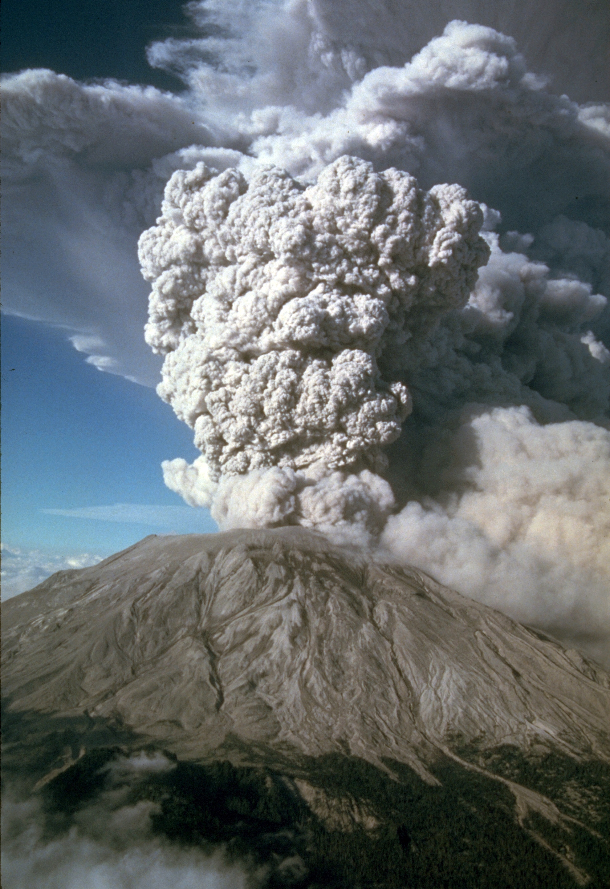
The Mountain Blew Sideways
Most volcanic eruptions blast upward. Mount St. Helens did something far stranger on May 18, 1980: after a magnitude 5.1 earthquake shook the mountain, its entire north face collapsed and the eruption exploded sideways.Mount St. Helens: The Eruption That Blew Sideways
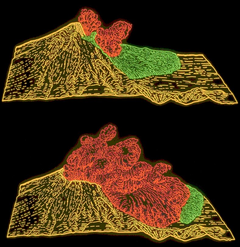
The Slope Was Already Failing
For weeks, magma had pushed the mountain's north side outward, creating a huge bulge that grew 5 to 6 feet per day. When the quake hit at 8:32 a.m., that weakened side gave way in the largest subaerial landslide in recorded history.Mount St. Helens: The Eruption That Blew Sideways