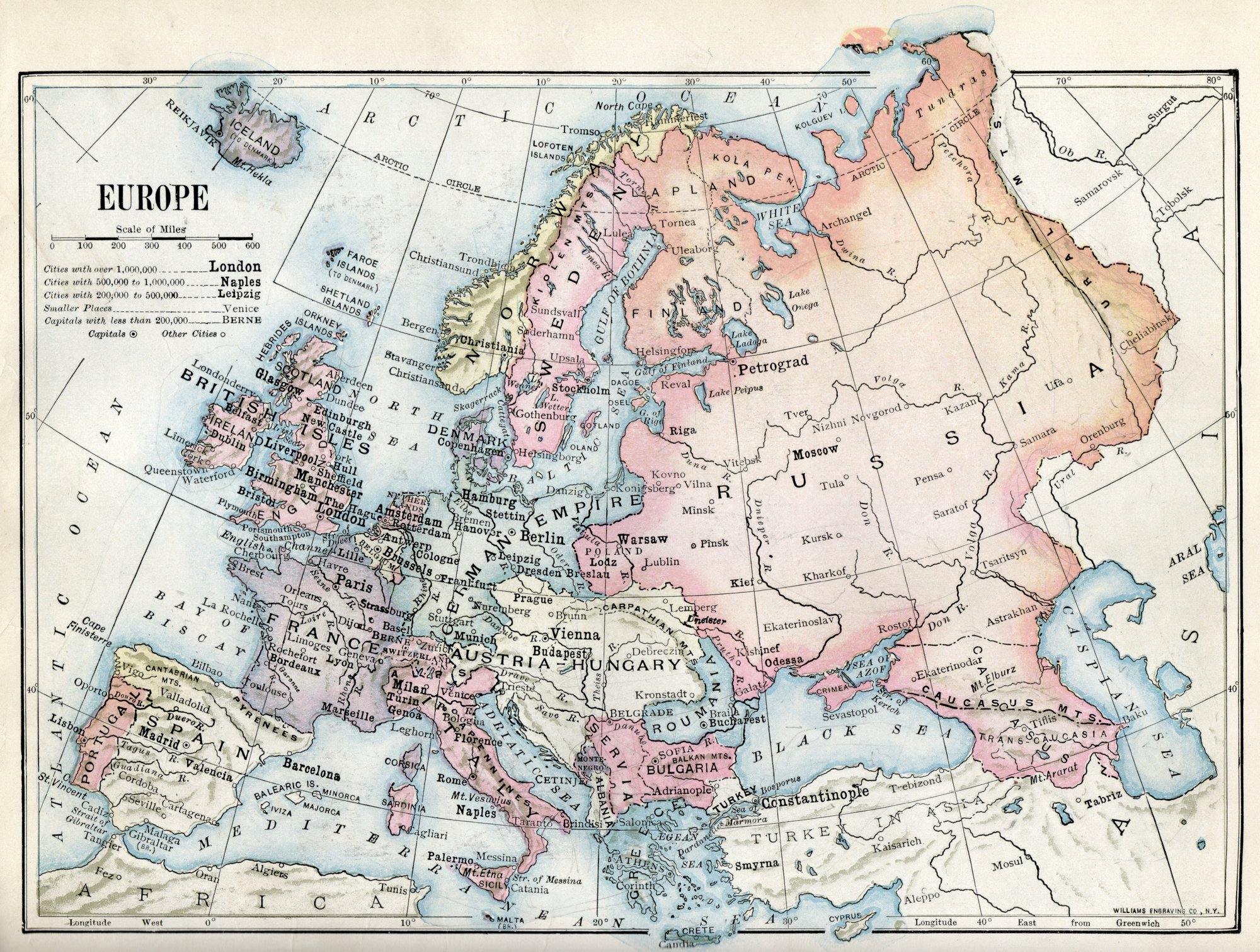
Where does Europe actually end?
Rivers? Mountains? Straits? There is no single natural border with Asia, and the line has shifted for centuries.Where Does Europe End? The Moving Border with Asia
From rivers to ridges
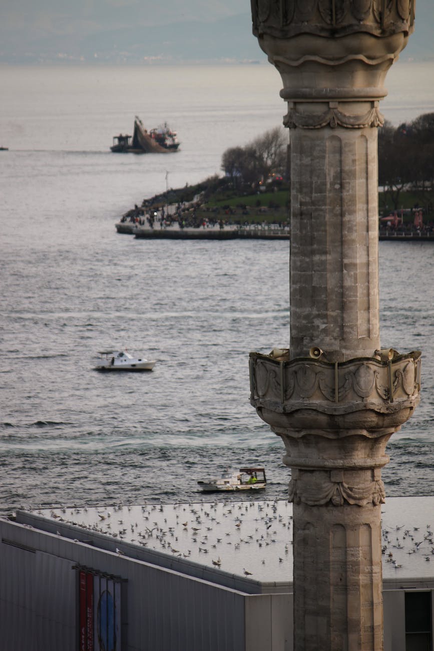
Ancients drew the line along the Don and the Turkish Straits. Today many use the Urals, Ural River, Caspian, Caucasus, Black Sea, and Turkish Straits.Where Does Europe End? The Moving Border with Asia